My Favorite City - San Francisco
|
|
click for large view | ||||
 |
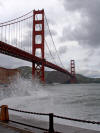
San Francisco Golden Gate Bridge entrance to San Francisco Bay |
 |
|||
| Street scene - Montgomery & Market Streets | Golden Gate Bridge from Fort Point |
From Santa Barbara to the border of Oregon, the coastal mountain ranges of
California rise steeply from the sea. Only once is this wall open to the ocean.
That is from the Pacific Ocean into San Francisco Bay through the opening under
the Golden Gate bridge. Through this narrow gap flows a variety of weather
conditions.
During the summers, on the west end of San Francisco that borders the Pacific
and carries cold currents from Alaska, you can find people wearing winter
jackets to protect themselves from the chilling, wind-driven fog rushing in off
the Ocean. At the same time, a few miles to the east, on San Francisco's Mission
Street, you will see people wearing T-shirts enjoying sunny, warm weather. At
its thickest, fog blankets everything and advances inland in the form of vapor
as much as one million gallons of water an hour.
The best way to see the varied sections of San Francisco is on foot. Walk up and
down the many, interesting hilly streets and visit numerous museums, art
galleries and shops. The cable cars can help visitors over the city's many steep
streets. Chinatown's sounds, music, aromas, and Oriental shops can only be
experienced by walking.
San Francisco Bay Area enjoys a "Mediterranean" type of climate
The unique weather conditions found in the San Francisco Bay Area are caused by
several important geological, physical, and meteorological phenomena.
Generally speaking, the San Francisco Bay area enjoys a type of weather referred
to as "Mediterranean" because of its similarity to the climate in that area of
the world. Rather than four distinct seasons, there are only two seasons: a
rainy season and a dry season. The temperature in the Bay Area is fairly constant,
with much less fluctuation annually than in other parts of the country. Several
atmospheric conditions coupled with unique geological features provide a
situation conducive to fog, sea breezes, and advection. All of these produce a
"greenhouse" effect over much of the peninsula.
Weather may vary greatly throughout the Bay Area. Attempting a detailed
description of
"Bay Area Weather" would be a grandiose undertaking. However, it is possible to state the
overall controlling factors which produces this wide range of weather conditions
throughout the S.F. Bay Area.
Over the Pacific Ocean, somewhere north of the Hawaiian Islands and west of San
Francisco, a large, heavy air mass begins to collect during the early spring
months. This mass of cool air is called the Pacific High." Normally, air tends
to move outward away from a high pressure zone in all directions toward low
pressure zones such as the coast of northern California. However, as this cool
air passes eastward, it is affected by the rotation of the earth turning
underneath it so that by the time the air mass reaches California, it is moving
southeast nearly parallel to the coast. This spinning or swirling effect of air
masses due to the earth's rotation is called the "Coriolis Force." There is
really no force involved but an effect. The effect results in movement of ocean
currents which flow at 45ø angles to the main flow of air. This pushes large
masses of waters along our coasts.
As the air passes over the Pacific, it absorbs large quantities of water and
heat through evaporation from the ocean. This heavily ladened air then strikes
the coast, and is deflected away as it is piled up seaward by the coast ranges. The
buildup of water-saturated air can enter the land areas only through several
passes through the mountains, the largest of which is the Golden Gate.
The ocean waters themselves tend to be affected by the Coriolis Force of the
earth's rotation so that cold arctic waters are carried eastward and southward
toward the California coast. In the spring, when the Pacific High builds up
north of the Hawaiian Islands, the resulting winds rushing across the ocean's
surface push the water before them producing oceanic currents. This surface
displacement of water is compensated for by an upwelling of cold water from
deeper areas so that as the currents flow past northern California, the water
temperature drops drastically, sometimes into the low 50's øF.
As the water-ladened air passes over the chilled ocean waters, it is cooled and
its ability to retain the moisture is lessened to the point that condensation
occurs. This condensation rushes into the Golden Gate gap in the form of damp,
chilling fog. This cold, foggy mist is heavier than the warm air above it, so it
tends to remain close to the surface. During the spring months, it can be seen
pouring into the Golden Gate, sometimes under the Golden Gate Bridge, obscuring
the drivers' view of the Bay, as they drive toward Marin which is basking in
bright, clear sunshine.
During the early spring and summer months, the increased intensity of the sun
begins to warm the land of the Great Valley which lies between the coast ranges
and the Sierras to the east. As the land warms up, the air above is also warmed
by radiation, causing the air to expand, creating currents. These currents of
warm air move down the western slopes of the Sierra ranges, across the Great
Valley, and over the Diablo Range and through the Sacramento River gap into the
San Francisco Bay Area. The cool ocean air, heavy with its moisture of
evaporated ocean and Bay waters, cannot rise above the overlying warm air.
As the cool ocean breezes flow into the Bay Area, they begin to pile up behind
(west of) the Diablo Range Buttress. This forces the condensation layer higher,
giving the summers their characteristic high fogs. This creates a "greenhouse"
effect which tends to maintain a relatively constant temperature winter,
spring, and summer.
San Francisco Bay is a large, shallow body of water. Its ability to absorb large
quantities of radiant heat helps maintain the cool, lower-level temperatures
during the otherwise hot summer months. As the summer sun shines down into the
San Francisco Bay region, evaporation from the Bay occurs on a huge scale. This
cooling evaporation helps retain the cool, moisture-ladened fog ("greenhouse"
effect) and, incidentally, our mild summers.
The fall months of October and November are characterized by a drop in the
strength of the Pacific High, and the moisture-ladened westerlies. This allows
the hot, dry valley air to penetrate to the coast, and the Bay Area experiences
its "summer," or prolonged "Indian Summer."
By the end of November, the winter wet season (or rainy season) has usually
begun. This cool-rainy period will last until late February, when the Pacific
Highs again begin to build up north of Hawaii. During the winter months, the
wind patterns are reversed, bringing warm, moist air into the Bay Area from the
South. As the warm, moist, oceanic breezes pass over the cooler land masses,
condensation and rain occur. The rains last until the early spring when the
"Pacific High" is re-established to start the annual cycle over again.
extracted from: WEATHER ("The Natural History of the San Francisco Bay Area.
A Field Guide to") by Williams & Monroe, McCutchan Publishing Corp, Berkeley,
1970)